Leaving Yushu, Following the Yellow River Downstream
Contents
A small stream rises at the foot of the Bayan Har Mountains. This is Yueguzongliequ, one of the sources of the Yellow River. It flows eastward out of Yushu and into Golog, where it eventually reaches Gyaring Lake and Ngoring Lake, two important freshwater lakes in the upper reaches of the Yellow River.
A Kingdom of Animals
The eastern sky was just beginning to brighten when we drove away from the hotel. We had a long journey ahead, and most of today’s route would be on dirt roads not marked on the map. Starting early was clearly the right choice.
Just after leaving Qumarlêb County and crossing the first mountain pass, the sun rose above the horizon and lit the distant peaks. The animals were also beginning their day, feeding quietly on the grasslands beside the road. The first animals we encountered were Przewalski’s gazelles, most easily recognized by their white rumps. They usually appeared in groups and would raise their heads to watch us cautiously whenever the car passed.
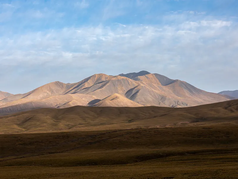
The sun had just risen above the horizon, and the low-angle light illuminated only the upper half of the mountain
Canon EOS 5D Mark IV
EF 70-200 f/2.8L IS III USM
F9 | 1/125 s | 88mm | ISO 100
The road from G215 toward Maduo Township was newly paved. From the guardrails still under construction along the roadside, it was clear that the asphalt had only recently been laid and the road had not yet been fully completed. A road worker told us that the paved section would end about 50 kilometers before Maduo Township, after which it would become a dirt road. Along the way, we crossed Jiaqiaozhexina Pass at an elevation of 4,838.9 meters, the highest point of this trip through Yushu.
After passing Qiuzhi Township, wild animals began appearing more frequently, with Przewalski’s gazelles still the most common. Ponds beside the road were often occupied by large flocks of long-legged white birds. I did not know exactly what they were called. They usually gathered closely together in large groups, making the ponds look unusually lively. If we stopped and walked a little farther away from the road, all kinds of animal tracks could be found in the soft ground.
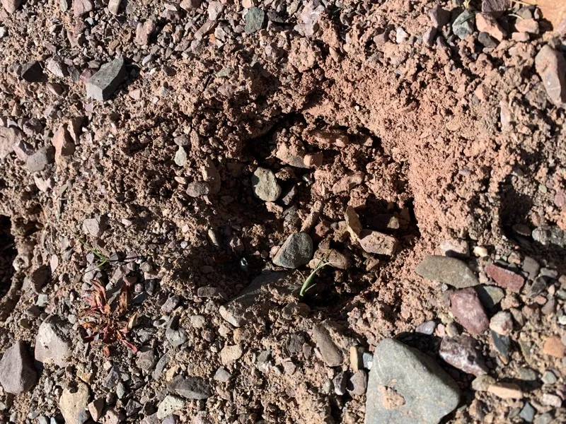
Tracks from an animal I could not identify
iPhone XS
As expected, the paved road ended before we reached Maduo Township. About 50 kilometers from the township was a three-way junction. Apart from the road back toward Qiuzhi Township, one road continued along the main route to Maduo Township, while a smaller track headed directly toward the core area of the Yellow River source. Most visitors approach the source from Maduo Township, traveling west before turning south off the main road. The advantage of that route is that it is easy to follow and involves fewer difficult sections, making it more predictable. We chose instead to take the smaller road directly toward the Yellow River source and then continue east to Maduo Township, avoiding the need to retrace our route.
The risk of taking the smaller road was that the conditions were more complicated and there were fewer travelers. Getting stuck would have been troublesome. But the weather had been good for several days, and the forecast showed no rain, so it did not seem too risky. Looking back now, taking this route was a very good decision. It also allowed us to avoid some local Tibetans charging travelers to pass, which saved us quite a bit of trouble.
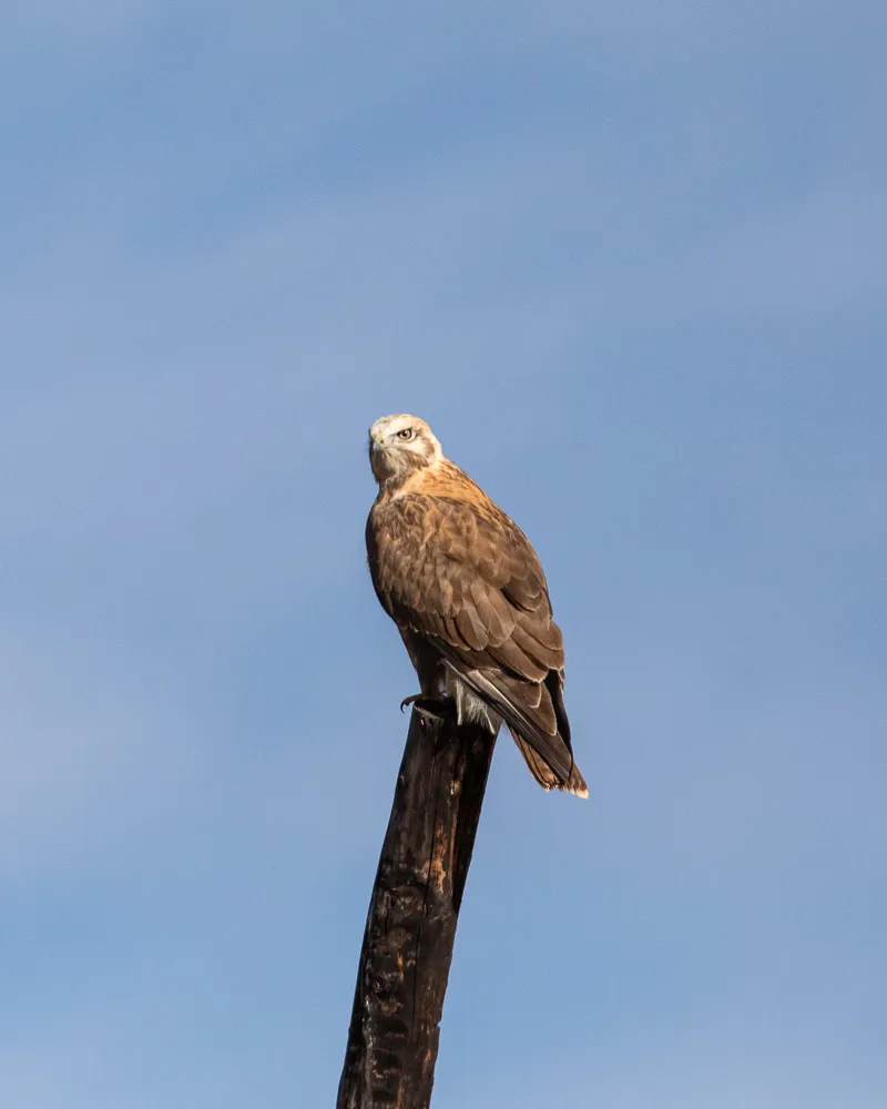
An eagle on the plateau
With fewer predators such as wolves and eagles, hares have become extremely numerous on the grasslands. Many artificial nesting poles have been built across the plateau to give eagles safe places to nest and reproduce, helping control the hare population.
Canon EOS 5D Mark IV
EF 70-200 f/2.8L IS III USM + 2X III
F6.3 | 1/8000 s | 400 mm | ISO 800
Because this was not a popular tourist route, especially compared with the road from Maduo Township to the Yellow River source, we encountered no other vehicles apart from two Tibetan pickup trucks.
Wooden poles resembling utility poles stood along both sides of the road, each with something like a shopping basket attached to the top. My first thought was, “There are actually streetlights here?” But after thinking about it for a moment, that clearly made no sense. Installing streetlights in an almost uninhabited area like this would have been absurd.
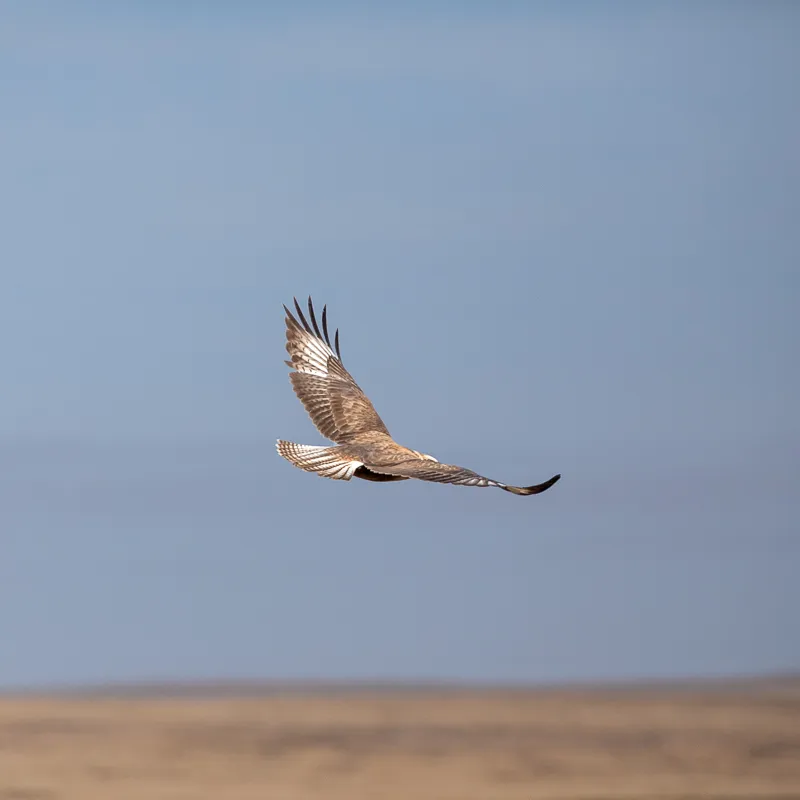
Wings spread
Canon EOS 5D Mark IV
EF 70-200 f/2.8L IS III USM + 2X III
F6.3 | 1/8000 s | 400 mm | ISO 800
In fact, the poles were built as nesting sites for eagles. Frequent human activity on the grasslands, together with excessive hunting of wolves, bears, eagles and other predators, had allowed animals such as pikas to multiply rapidly, causing serious damage to the grassland ecosystem. To reduce the impact of these small mammals, which eat grass roots and contribute to grassland degradation, a solution based on the food chain was introduced: provide better breeding conditions for their natural predators and gradually restore balance to the ecosystem.
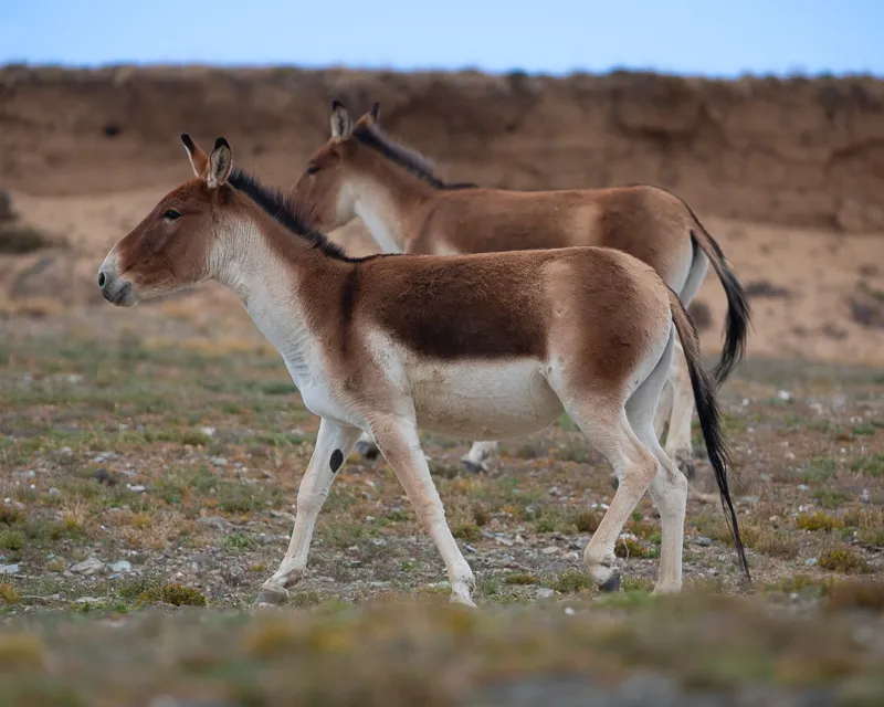
Tibetan wild ass
Canon EOS 5D Mark IV
EF 70-200 f/2.8L IS III USM + 2X III
F5.6 | 1/1000 s | 400 mm | ISO 800
Eagles are close to the top of the food chain here and mainly prey on animals such as hares and marmots, making them important in controlling these populations. The poles mentioned earlier were designed specifically to make nesting easier. Eagles can build nests and reproduce in the baskets at the top, increasing the survival rate of their young and helping to further control the numbers of hares and similar animals.
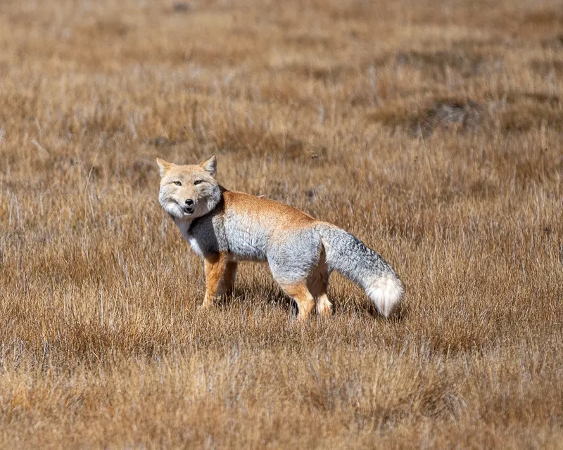
A Tibetan fox, well known online for its expressionless face and broad head. This one had just finished chasing prey and was breathing heavily with its mouth open.
Canon EOS 5D Mark IV
EF 70-200 f/2.8L IS III USM
F5.6 | 1/8000 s | 400mm | ISO 800
We also encountered another animal unique to the plateau several times along the way: the Tibetan fox, famous online for its expressionless face. Its broad head and indifferent-looking eyes have made it instantly recognizable, while its thick, fluffy tail adds an almost comic quality. Tibetan foxes mainly prey on rodents. The award-winning photograph The Tibetan Fox and the Himalayan Marmot from the 2019 Wildlife Photographer of the Year competition captured exactly such a confrontation. Taken in Qinghai, the photograph is full of drama and freezes a moment of life-and-death struggle. Anyone interested can easily search for it.
Yueguzongliequ, Source of the Yellow River
E95°59′26.87″ N35°1′11.59″
The Yellow River is often called China’s Mother River. It rises on the northern slopes of the Bayan Har Mountains. I mentioned the Bayan Har Mountains in the previous article, Sacred Mount Gado Jowo. They are a mountain range in southern Qinghai whose main peak is Nyenbo Yurtse. The Yellow River also rises here before flowing eastward. Yueguzongliequ is one of its sources and was once considered the main source of the river. Today, Kariqu is more commonly regarded as the principal source, based on factors including drainage area, discharge and flow rate.
For this trip, however, we still chose Yueguzongliequ as our destination because many monuments and geographical markers remain there.
The dirt road leading from the paved road toward Yueguzongliequ was generally in good condition and relatively flat. Occasionally, damaged culverts or washed-out sections forced us to detour through water. We crossed one low hill after another, gradually approaching the location marked as the Yellow River source on the GPS. Yet the landscape around us barely changed, which made us wonder whether we had somehow taken the wrong road.
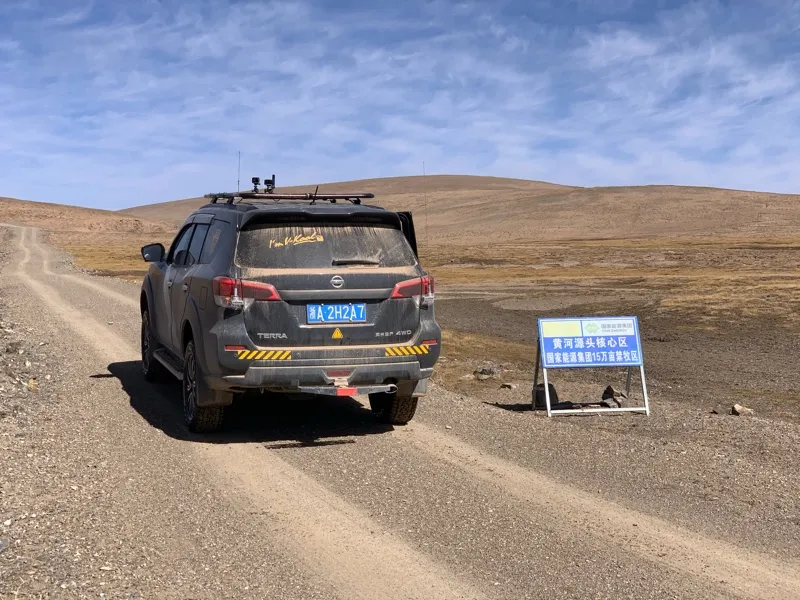
A sign marking the core protected area of the Yellow River source. I hope everyone entering the Sanjiangyuan protected area will take responsibility for protecting the environment: take away all rubbish and leave only tire tracks on the road.
iPhone XS
Finally, after crossing another small hill, we saw prayer flags ahead. They suggested that the source must be nearby. From the hilltop, we could see several stone monuments scattered across the valley, confirming that this was Yueguzongliequ, one of the sources of the Yellow River. I was too excited for words. I shifted into first gear and slowly rolled downhill.
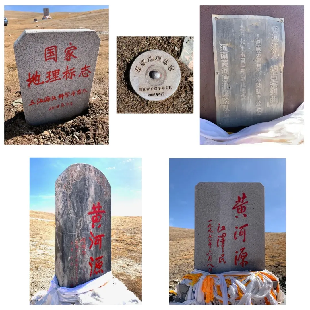
Various monuments and geographical markers near the source of the Yellow River. From top to bottom and left to right:
1 National geographical marker, erected by the Sanjiangyuan scientific expedition team in September 2008;
2 National geographical landmark, erected by the Sanjiangyuan scientific expedition team in September 2008;
3 Yueguzongliequ monument, erected by the Henan Yellow River rafting expedition in May 1987;
4 Yellow River Source monument inscribed by Hu Yaobang, erected in 1981;
5 Yellow River Source monument inscribed by Jiang Zemin, erected in 1997.
iPhone XS
The Yellow River is the fifth-longest river in the world, stretching 5,464 kilometers through nine provinces before entering the Bohai Sea in Shandong. I still remember first seeing a photograph of its source in a middle-school geography textbook. Beside a small flowing stream stood a stone marker with “Source of the Yellow River” written in Chinese and Tibetan, with a yak skull placed below it. That was my first impression of the Yellow River source, and from then on I had always wanted to see it for myself.
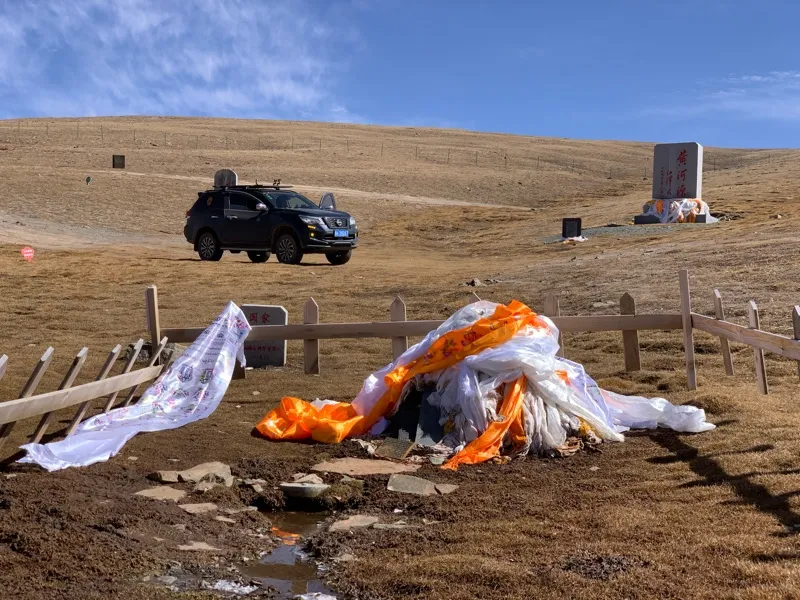
The source of the Yellow River, Yueguzongliequ
This unremarkable little stream is a source of China’s Mother River, the Yellow River. Opinions differ on the location of the river’s principal source, but one widely accepted view identifies Yueguzongliequ—the stream shown here—as that source. Unlike the Yangtze, which rises near the glaciated Geladandong Peak in the Tanggula Mountains, the Yellow River begins without towering peaks or glaciers nearby. Water seeps from the ground and trickles into the distance, beginning its long journey.
iPhone XS
It was difficult to imagine that the unremarkable stream before us was the source of the Yellow River. Clear, narrow, and quiet, it flowed like a newborn river—small but full of life. From here, it grows wider and stronger, supporting communities downstream and bringing them precious water. In Tibetan, Yueguzonglie means “a shallow pan for roasting barley,” a name derived from the plateau basin where the stream originates.
Looking back at this trip, it began by traveling upstream along the Yellow River and ended by following it downstream. In Lanzhou, I saw the river heavy with sediment; in Guide, I saw it clear and broad; in Longyang Gorge, I saw it confined by the canyon; in Darlag, I saw it beneath the setting sun; in Maduo, I saw the newborn river; and in Madoi, I saw it flowing into the twin lakes.
To Maduo Township
Compared with the road into the Yellow River source, the road out was much busier. During the National Day holiday, many vehicles came to visit, and almost all of them entered and left from the direction of Maduo Township. After eating a self-heating rice meal for lunch at the source, we set off toward Maduo Township. The first traveller we encountered was a young man cycling alone from Beijing. Farther ahead, we met a Patrol China convoy heading toward the source in a long line.
As we approached the main road, we ran into something unpleasant. A Tibetan household beside the road had placed a retractable gate across the track and was charging 50 yuan per person to pass. Looking around, we noticed other tire tracks leading toward the main road, so rather than pay, we turned back and followed another track. Just as we were about to reach the main road, another Tibetan man rushed over and gestured as though he wanted money as well. We did not stop. I gently pressed the accelerator, reached the main road and continued toward Maduo Township. These days, once a place becomes even slightly popular, the travel experience often gets worse, with people setting up roadblocks and charging money. By comparison, remote and less visited places usually make better destinations, and along the way you often meet genuinely helpful and friendly people.
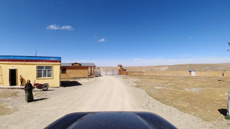
A Tibetan household charging travelers to pass, with the courtyard gate placed directly across the dirt road.
GoPro 7
From the Yellow River source to Maduo, off-road vehicles constantly roared past us, throwing up clouds of dust. Pajero convoys, Prado convoys, Land Cruiser convoys and Patrol convoys all headed toward the source. It was quite unexpected. I had assumed the Yellow River source would be relatively quiet, only to discover how busy it actually was.
Maduo Township lies about 50 kilometers east of the source. Before the trip, I had collected quite a lot of information about the township and had always imagined it as a place with only a few households and no gas station. The reality was very different. Tourism had brought rapid development. A number of new buildings that appeared to be hotels had been constructed, and there was now a gas station as well.
Maduo Township was roughly the halfway point of today’s journey. I had been worried that fuel might become a problem, but with a gas station here, the rest of the journey suddenly became much easier. The fuel was relatively expensive and there was no 95-octane gas, but for a sturdy Nissan Terra, neither was much of a problem.
Following the River Downstream
Following the Yellow River downstream from Maduo, before reaching Gyaring Lake, there is an area marked on maps as Xingxiu Hai, the Sea of Stars, at an average elevation of around 4,000 meters. Three source streams of the Yellow River, Kariqu, Yueguzongliequ and Zhaqu, flow in from different directions, creating a large wetland filled with many small lakes. These lakes of different sizes are scattered across the wetlands like stars, which is how the area received its name. Yueguzongliequ and Kariqu join to form the Maqu, which flows into Xingxiu Hai and then onwards into Gyaring Lake.
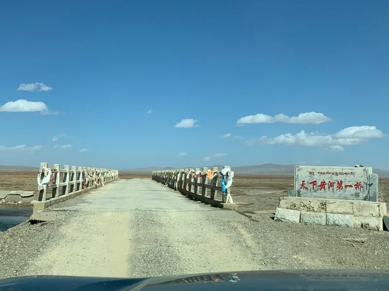
The first bridge over the Yellow River, photographed on the road from Maduo Township to the twin lakes, Gyaring Lake and Ngoring Lake
iPhone XS
After about 60 kilometers, a strip of blue appeared on the horizon. We had finally reached Gyaring Lake. Gyaring Lake and Ngoring Lake are the two largest freshwater lakes in the upper Yellow River. At an average elevation of around 4,300 meters, each is roughly comparable in size to Hala Lake, a saltwater lake in Haixi Prefecture beneath Tuanjie Peak in the Qilian Mountains. Both lakes are important habitats for fish and migratory birds.
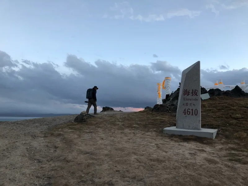
The mountaintop between Gyaring Lake and Ngoring Lake where the bull-head monument, commonly associated with the “Source of the Yellow River”, is located.
iPhone 8
At this point, the Patrol convoy we had met earlier at the Yellow River source caught up from behind, raising a huge cloud of dust as it passed. We became caught up among them and followed the lead vehicle toward Ngoring Lake. The convoy traveled quickly, leaving little time to look at the scenery outside the car. At that moment, I was glad we had traveled alone. Going independently requires more effort and time than joining an organized commercial convoy, but the freedom and interest it offers are difficult for a commercial driving tour to match.
For most tourists, the area around Gyaring Lake and Ngoring Lake is regarded as the source of the Yellow River, and most visitors stop at the bull-head monument between the two lakes. By the time we reached the foot of the hill, the sun had already dropped below the horizon, leaving a pale blue sky. The wind had also gradually died away, and the surface of the lake was calm. We walked up to the bull-head monument at an elevation of around 4,600 meters and photographed Ngoring Lake after sunset.
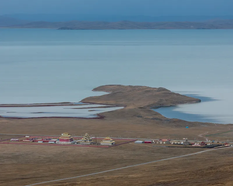
Ngoring Lake after the sun had dropped below the horizon. The land extends into the lake to form a peninsula, with houses arranged neatly along the shore.
Canon EOS 5D Mark IV
EF 70-200 f/2.8L IS III USM
F20 | 1.3 s | 168 mm | ISO 100
By the time we came down from the bull-head monument, it was completely dark. The road from Ngoring Lake to Madoi County was washboard dirt all the way. We drove slowly through the darkness for two and a half hours before finally reaching the county town. Madoi’s importance as a stopping point was obvious from how full its hotels were. We asked at several places and were told that every room had already been booked. In the end, we finally found somewhere to stay on the edge of town and brought the day’s journey to an end.
Other Information
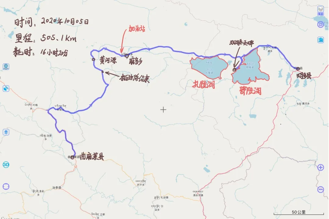
Journey route
· END ·