Sacred Mount Gado Jowo
Contents
Mountains are hardly rare on the Tibetan Plateau, the world’s third pole. But some mountains take on a different meaning because of geography, culture, religion and tradition. Gado Jowo, a mountain of relatively modest height in central Yushu Prefecture, stands apart because of its status as a sacred mountain.
Tongtian River
After flowing through Yushu City, the Batang River continues for more than twenty kilometers before joining another major river, the Tongtian River. From their confluence, the river continues south as the Jinsha River into Sichuan Province. The Tongtian River and Jinsha River are both part of the upper main stream of the Yangtze, which eventually reaches the Pacific Ocean at Shanghai after flowing through eleven provinces.
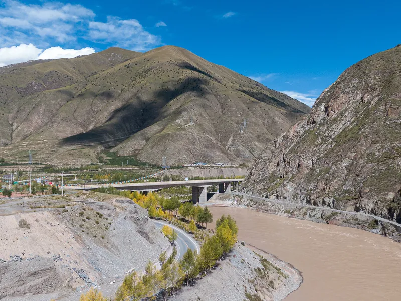
The Tongtian River and its bridge
DJI Mavic 2 Zoom
If you travel along G214, not far from the confluence of the Batang River and Tongtian River, you can see a road sign marked “Scripture-Drying Platform”. In the final ordeal of Journey to the West, “The Old Turtle of the Tongtian River Soaks the Scriptures”, the four travelers are thrown into the river because they forgot to ask the old turtle’s age after he helped them cross the Tongtian River. The place where they came ashore and dried their soaked scriptures is said to be the Scripture-Drying Platform. Of course, Journey to the West is a novel, neither a historical record nor a documentary source, but the Tongtian River and Scripture-Drying Platform mentioned in it are real places.
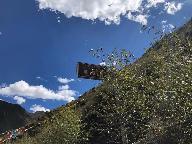
The Scripture-Drying Platform beside the Tongtian River. I took this from the car while passing, so the whole site is not visible.
iPhone 8
Beside the G214 bridge across the river is another abandoned bridge running parallel to it, with a stone marker at the entrance reading “Tongtian River Bridge”. Vehicles are no longer allowed to use this old bridge, but the colorful prayer flags covering it show that it is still remembered. Beside the bridge monument on the riverbank is a small park. It is not large, but it carries the grand name “Sanjiangyuan National Park”. The park itself has little to do with the actual headwaters of the three rivers. It was built simply because the sources of the Yangtze, Yellow and Lancang rivers, the last of which becomes the Mekong after leaving China, are all located in Yushu.
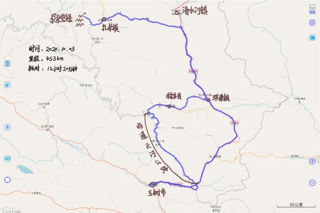
The concrete road running north from Sanjiangyuan National Park alongside the Tongtian River is unnamed on every version of the map I checked. The scenery along it is ordinary and not especially memorable, but several rough and basic tunnels along the way are quite interesting. Turning onto this road from G214 and traveling north for more than 40 kilometers brings you to Chindu County.
East of Gado Jowo
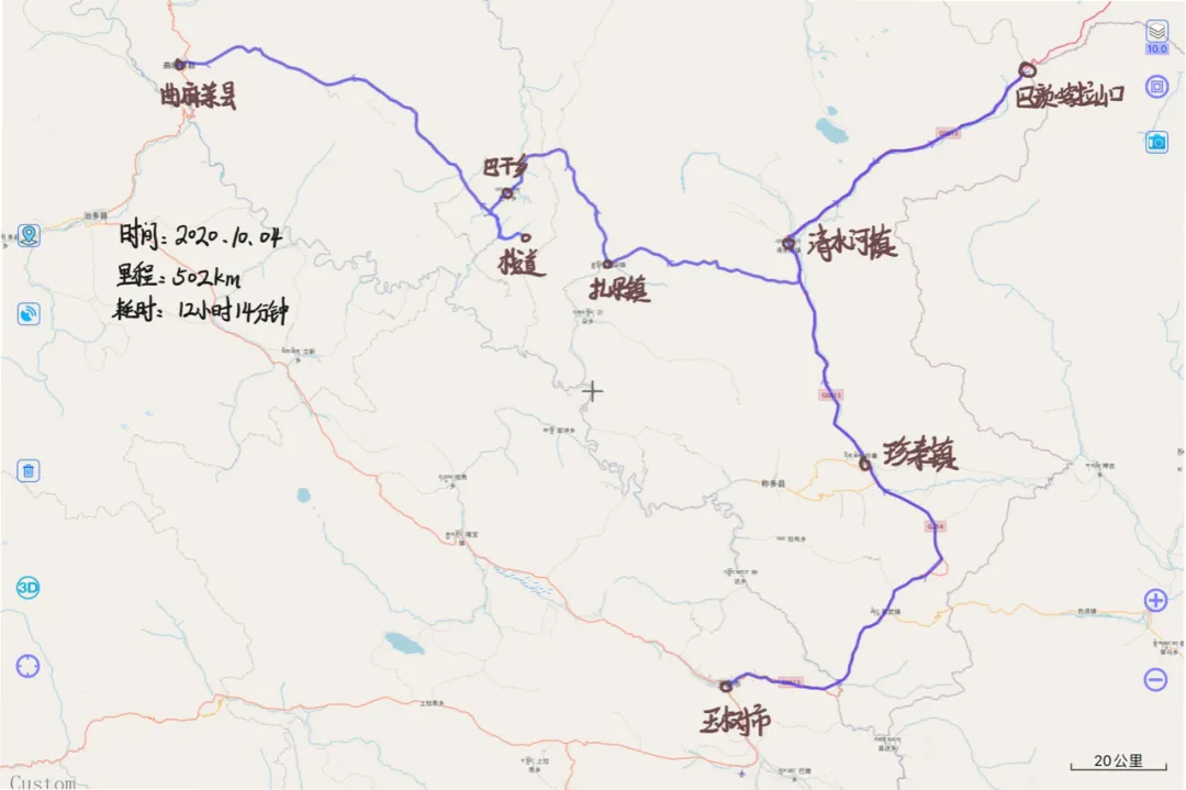
Traveling north from Zhenqin Township in Chindu County, just before reaching Qingshuihe Town, a road turns west. This is Provincial Highway 308 toward Qumarlêb County. This section has typical plateau grassland scenery, with gently rolling hills covered in pasture. Near Gado Jowo, the highway passes through the busy town of Zhaduo, full of people and traffic, a strong contrast with the sparsely populated road behind us. From Zhaduo, a concrete road runs southwest toward Saikang Monastery. Continuing deeper along the dirt road beside the monastery eventually brings Gado Jowo itself into view. Gado Jowo consists of a main peak surrounded by a series of other peaks. The main summit rises to more than 5,300 meters, not particularly high by Tibetan Plateau standards, but its distinctive form and sacred status still make it memorable.
Today’s destination was a valley on the eastern side of Gado Jowo. It is neither a tourist site nor a recognized landmark, just a point I had casually marked on a satellite map. Before actually reaching it, I was not sure whether the sacred mountain would be visible at all. But as we followed the dirt road deeper into the valley and the peaks finally appeared, I could not help feeling excited. The houses below the mountain seemed no longer permanently inhabited. Larks flying back and forth had become the real residents here, playing freely and filling the valley with their calls.
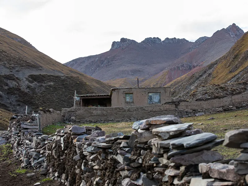
A valley on the eastern side of Gado Jowo. This house no longer appears to be permanently occupied.
Canon EOS 5D Mark IV
EF 70-200 f/2.8L IS III USM
F7.1 | 1/50 s | 70mm | ISO 125
A narrow river flows through the valley from Gado Jowo toward the lower ground. It is not a great river, but the sound of the water is no less impressive. Sitting quietly in the valley, I watched the light change from white to gold, then pink, and finally blue. Another day ended in this calm.
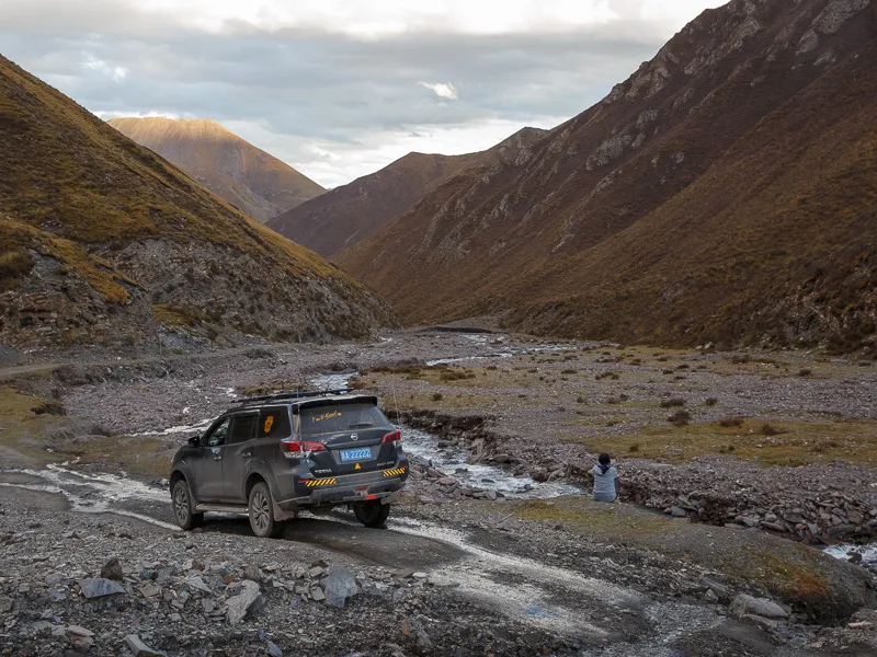
Sitting beside the river in the valley, waiting for sunset
Canon EOS 6D
EF 24-70 f/2.8L II USM
F8 | 1/125 s | 35mm | ISO 640
Saying Goodbye to Yushu City
It was after nine in the evening when we finally returned to Yushu City. We had been on the road all day and none of us had eaten dinner, so everyone was hungry. For some reason, I especially wanted grilled lamb that night, a food very common in Xining. But since it was everyone’s first time in Yushu, none of us knew where to find a good place. We decided to leave the difficult choice to a taxi driver and ask him to take us somewhere.
The Tibetan driver, who had never eaten grilled lamb himself, took us to a barbecue restaurant he knew. It was on the northeastern side of Yushu City and had a fairly small shopfront. More memorable than the grilled meat itself was the boiled tea, pronounced nao cha in Qinghai dialect, a hot drink made by boiling brick tea with salt and other seasonings. Its slightly bitter, salty taste was mixed with the sharpness of ginger and other spices, quickly warming anyone chilled by the cold plateau night. It tasted distinctly of home.
On the way back to the hotel after dinner, I looked at the brightly lit streets of Yushu City and felt a little emotional. As the only major city in southeastern Qinghai, Yushu has a comfortable altitude, complete facilities and friendly people, almost like a refuge on the plateau. It offers warmth, good food and entertainment to people arriving from colder, higher and poorer regions, allowing them to wash away the dust of the road. Knowing this would be our last night in Yushu City on this trip made me reluctant to leave, but I was also looking forward to returning one day.
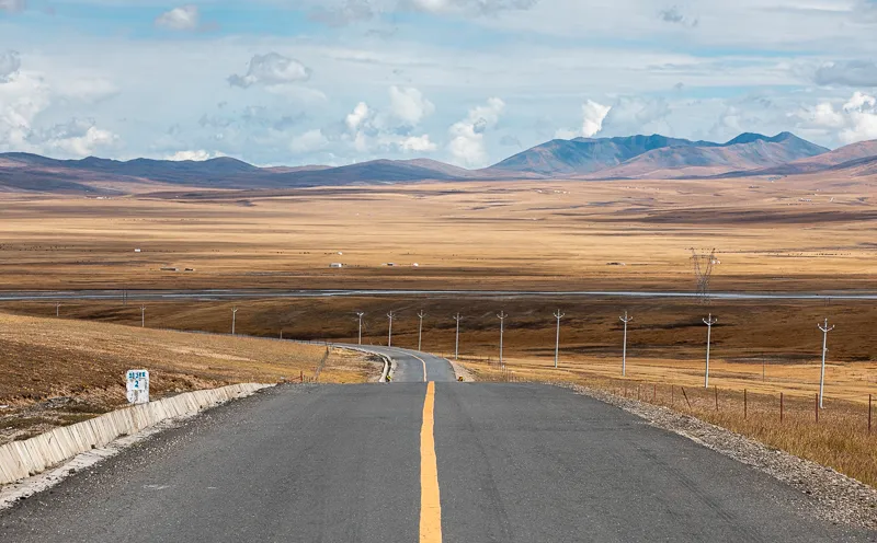
The land of Yushu
Canon EOS 5D Mark IV
EF 70-200 f/2.8L IS III USM
F11 | 1/320 s | 135mm | ISO 125
Bayan Har Mountains
The next day, before heading to Gado Jowo, we planned to visit Bayan Har Pass first. The Bayan Har Mountains are a range in the south-central part of Qinghai Province, whose main peak is the well-known Nyenbo Yurtse. Bayan Har Pass lies on the main expressway route from Xining to Yushu and was also crossed by Princess Wencheng on her journey to Tibet, showing its historical and geographical importance.
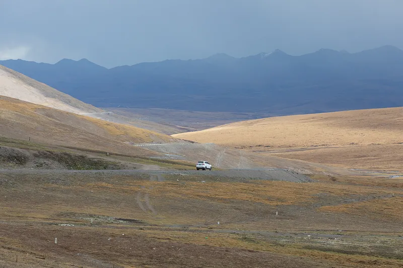
The road from Yushu to Qumarlêb County
Canon EOS 5D Mark IV
EF 70-200 f/2.8L IS III USM
F7.1 | 1/200 s | 190mm | ISO 125
From Yushu City, we took the Yushu–Gonghe Expressway to Qingshuihe Town, then left the expressway and continued north along the national highway to Bayan Har Pass. The section from Qingshuihe Town to the pass crosses extensive permafrost, and the road surface rises and falls, so extra care is needed while driving. We chose the national highway instead of the expressway mainly because there is no stopping area at the pass on the expressway, while the national road has a place to stop and prayer flags to look at.
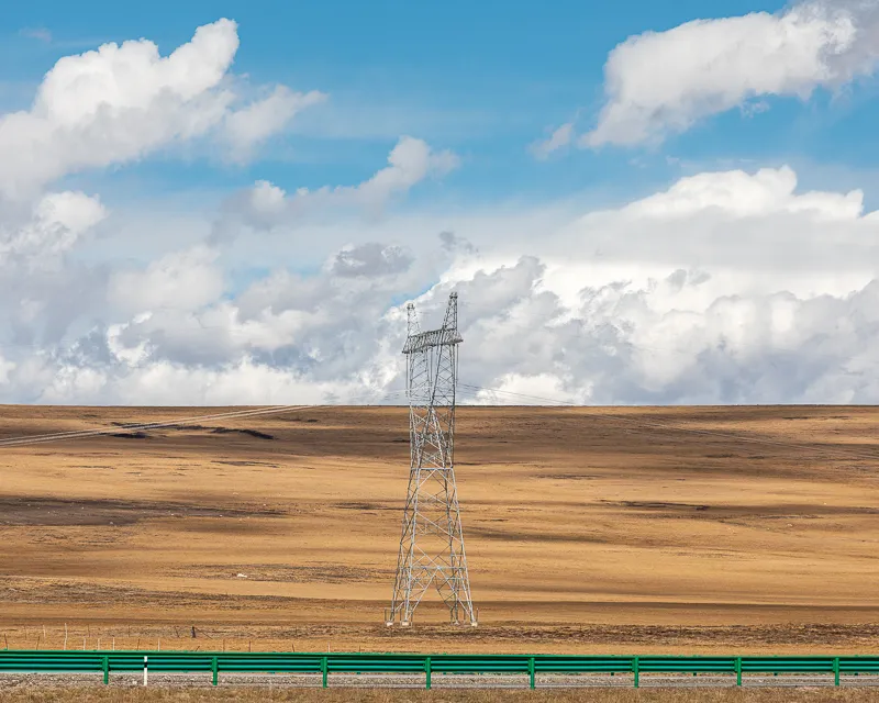
Grassland and clouds beside the expressway
Canon EOS 5D Mark IV
EF 70-200 f/2.8L IS III USM
F9 | 1/400 s | 200mm | ISO 100
Bayan Har Pass is not a tourist attraction, and the scenery itself is fairly ordinary. What sets it apart from other mountain passes is its historical importance and geographical location. When Princess Wencheng traveled to Tibet to marry Songtsen Gampo, she left Xi’an, passed through Xining and Riyue Mountain, continued south across Bayan Har Pass to Yushu, and then turned toward Lhasa.
Sacred Mount Gado Jowo
Continuing along the provincial highway from Zhaduo Town, we crossed Bangyang Mountain Pass and reached Bagan Township. From there, we left the main road and headed east through a canyon toward Gado Jowo. Apart from a few dirt sections caused by small landslides, the road was generally in good condition and easy to drive.
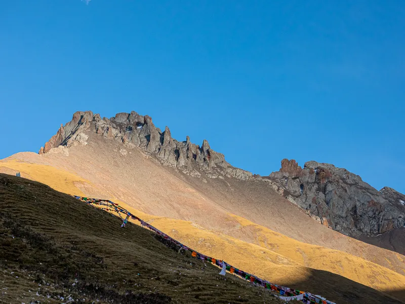
Gado Jowo
Canon EOS 5D Mark IV
EF 70-200 f/2.8L IS III USM
F5 | 1/3200 s | 70mm | ISO 1000
Compared with the eastern side we had visited the previous day, the western side of Gado Jowo was much busier. Construction was underway here, probably for a tourist site, and a dirt road from the construction area led east toward the foot of the mountain. On the eastern side of Gado Jowo, several routes through the valleys can reach the mountain, but because construction had blocked the scenic-area roads, this was the only route available to us. A Tibetan man preparing to leave after visiting the sacred mountain told us to follow the boardwalk ahead. There was a viewing platform on the distant mountainside, he said, and the view was worth seeing.
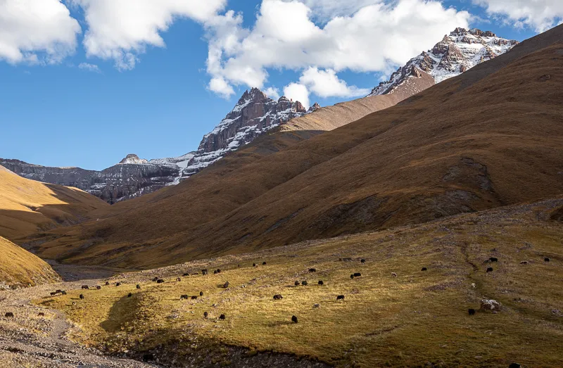
Pasture beneath Gado Jowo
Canon EOS 6D
EF 70-200 f/2.8L IS III USM
F14 | 1/50 s | 47mm | ISO 100
I put on my camera bag, picked up the tripod and started toward the viewing platform. I was not suffering from altitude sickness, but climbing at 4,300 meters while carrying more than five kilograms of equipment was still demanding. The boardwalk, about one kilometer long, felt almost like a pilgrimage route, testing everyone who wanted to see the sacred mountain. We joined the other travelers on that path, breathing heavily and stopping often, but unwilling to give up. Fortunately, the weather treated us well. The afternoon showers that had arrived almost on schedule during the previous few days never came.
Old and new prayer flags overlapped at the viewing platform, while wind-horse papers covered the ground. I wondered how long those prayers had gathered here. The sacred mountain itself had stood quietly for millions of years, waiting for everyone who came to ask for blessings, speak to it or pray before it, witnessing the joys and sorrows of human life and giving hope to those who faced it.
I quietly told the mountain my wish, waved goodbye and followed the boardwalk back down. By then, the herders living below the mountain were also bringing their yaks home. Seeing that we had just returned from the mountain, one of them warmly invited us to his home for tea. Unfortunately, we were short on time. After thanking him for his kindness, we drove on toward Qumarlêb County.
Qumarlêb
By the time we returned to the provincial highway from Gado Jowo, it was almost completely dark. On the road, we unexpectedly encountered white-lipped deer once again. This time the deer was larger and much closer, so close that we nearly hit it. Unfortunately, there is no photograph of the encounter. By the time I reacted and reached for my phone, it had already disappeared into the darkness.
After crossing Longjia Pass at an elevation of 4,812 meters, Qumarlêb County was not far away. A little farther down the road, the scattered lights of the county town appeared in the distance. I had assumed that a county town like Qumarlêb would at least provide a comfortable place to stay, but I soon learned otherwise: the infrastructure was extremely limited.
We found a hotel recommended by a friend. After dealing with a broken toilet, changing rooms and several other small problems, we could finally sleep. This was our final night in Yushu Prefecture during the holiday. Tomorrow, we would follow the Yellow River downstream from its source and return once again to Golog Prefecture.
· Other Information ·
· END ·