The Legend of Duolunduo
Contents
If the Tanggula Mountains and Hengduan Mountains form the body of Nangqên, then the stories of King Gesar, widely told across this land, are its soul. Duolunduo Village, a hidden paradise with a rather modern-sounding name, is where a thousand-year-old story unfolds.
When I hear the name Duolunduo, the first thing that comes to mind is Toronto, Canada’s largest city. But Duolunduo in Nangqên, Yushu, has no high-rises, no concrete towers, and no busy traffic. Hidden deep in the mountains, Duolunduo Village is naturally separated from the outside world: flowing water, salt fields, birdsong and flowers, quiet and warm. This is a true hidden paradise.
Hope Beyond the Impasse
The road from Qamdo in Tibet back into Duolunduo Village in Yushu, Qinghai, was clearly visible on the satellite map. But when we arrived, all we could see was a broad, empty riverbed. The concrete road from Qamdo ended abruptly at the Qinghai–Tibet border, leaving only faint tire tracks stretching toward Duolunduo.
We followed the tracks cautiously for less than a kilometer before they disappeared beneath the river. To make matters worse, strong winds began to blow and dark clouds rolled in again. Considering that rain upstream could cause the water level to rise, we turned back to the concrete road in Qamdo.
Sitting in the car and listening to the rain tapping on the roof, I felt a little discouraged. After comparing several different maps again and again, there was only one conclusion: if this road was impassable and we could not reach Duolunduo, the rest of the plan would have to be abandoned. But with heavy rain outside, there was nothing we could do except wait for it to stop and then explore again to see whether there was another way around.
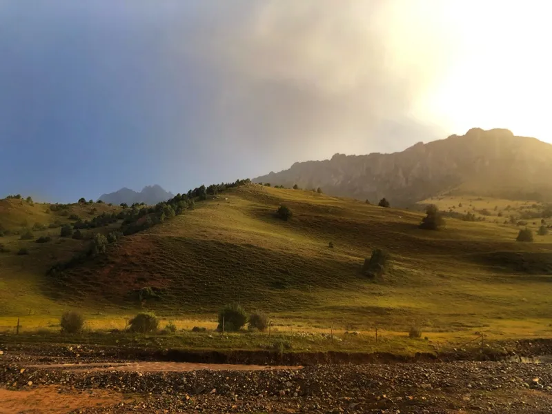
Waiting for the rain to pass in Qamdo
iPhone 8
As usual, the storm came quickly and left just as quickly. Just as I was preparing to walk ahead and scout the road, a Foton van approached from the direction of Qamdo. The driver was a handsome middle-aged Tibetan man.
“You can get to Duolunduo. Just follow me!”
Hearing those words, my frustration vanished and hope returned at once. It felt like waiting for exam results, expecting the worst, only to discover that I had somehow scored full marks.
We followed the van across several small rivers along the uneven riverbed. Only then did I suddenly realize that the route to Duolunduo had actually been marked by local Tibetans with stones. At important points, such as where vehicles needed to enter or leave the river, or where the route turned, stone markers had been placed. They were made by stacking smaller stones on top of larger ones again and again until they formed a pointed little tower.
The road from Qamdo to Duolunduo was ultimately less dangerous than it first appeared, apart from the van nearly breaking down beside the riverbed because of its age. We reached our destination safely before dark.
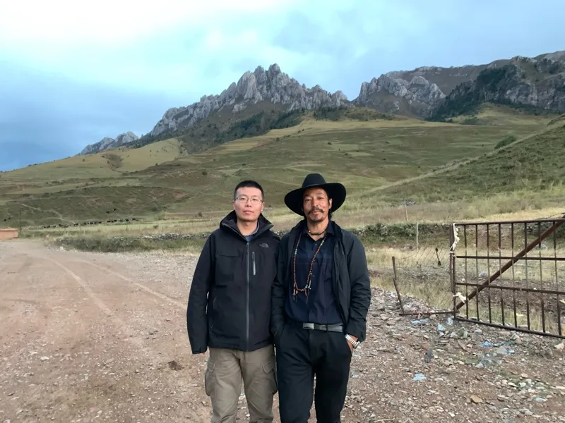
A photograph with the Tibetan man. Without his guidance, we would not have been able to reach Duolunduo Village.
iPhone XS
Revealing Duolunduo Village
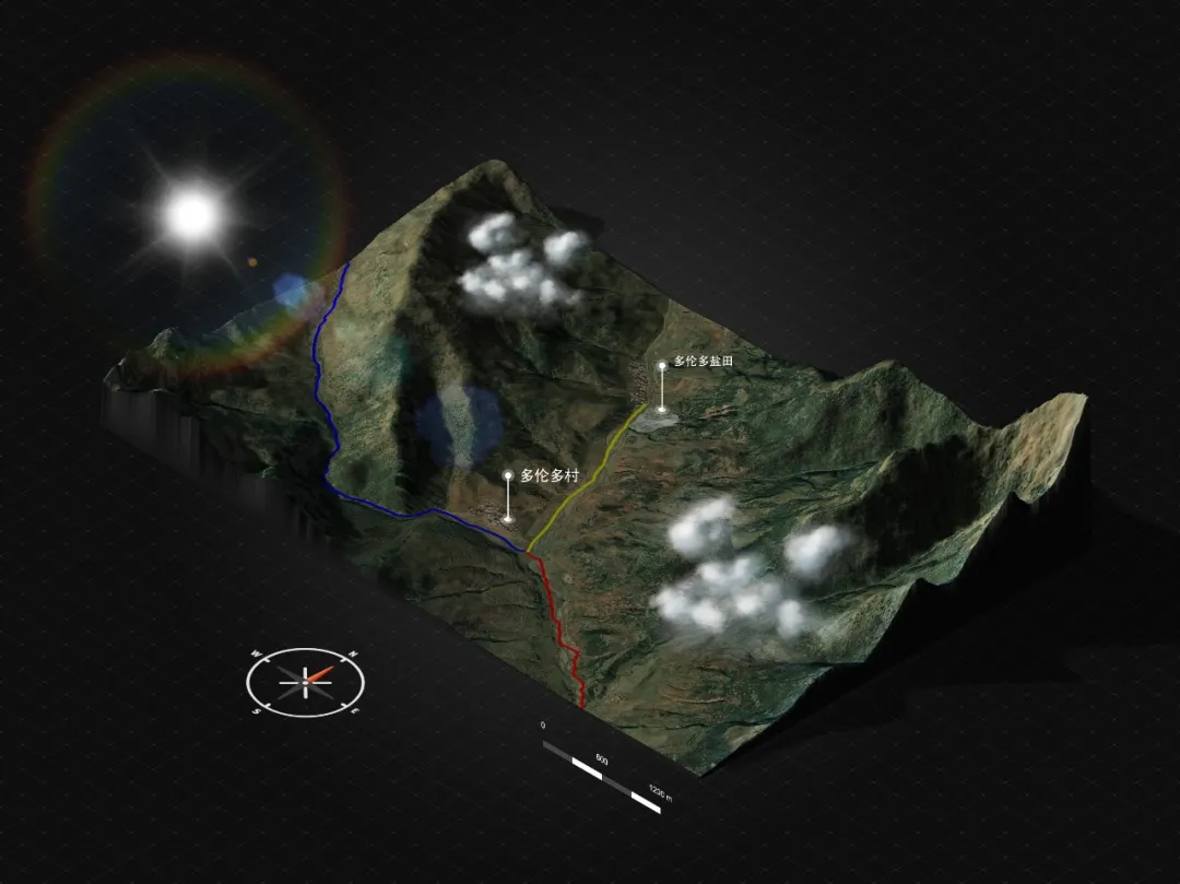
3D map of Duolunduo Village. The red line shows the route from Qamdo in Tibet to Duolunduo, the blue line shows the route from Duolunduo to Nangqên, and the green line leads to the salt fields.
Photoshop 3D map generator
After arriving safely in Duolunduo Village, the first thing we did was thank him. He smiled casually and said it was nothing, just a small favor. As everyone relaxed, we began talking.
It turned out that there had once been a proper road across the river toward Qamdo, but heavy rain that year had washed it away some time earlier. The “road” we had just taken had only been leveled across the riverbed because someone in the village was getting married and needed to go to Qamdo to collect the bride. The villagers had worked together to make the route passable. If we had arrived a few days earlier, we might genuinely have been unable to reach Duolunduo from Qamdo.
When he learned that we had come for the salt fields, he told us that Duolunduo had many other stories as well. He then pointed toward some damaged earthen walls on the hillside and said that this was where King Gesar’s mother had once lived.
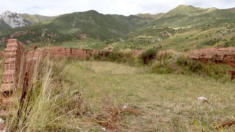
The former residence of King Gesar’s mother, now reduced to ruined walls.
Sony ZV1
Gesar is a hero of the ancient Tibetan people. He is said to have defeated evil people and demons and taught people how to work the land. His life story forms the world’s longest epic, one that is still being sung, told and expanded today. His deeds were already widely known among communities across the Tibetan Plateau, around Qinghai Lake, beneath Riyue Mountain and in the Sichuan Basin as early as the tenth and eleventh centuries. Even today, storytellers throughout Qinghai, Tibet, Sichuan and Yunnan continue to tell the stories of King Gesar and celebrate the hero.
Many stories about King Gesar circulate in Nangqên, but in Duolunduo Village, people more often pass down stories about his mother, Mayong. According to legend, when the king of Ling, Gesar’s father, led his army into the territory of Guo and reached Duolunduo, he met Mayong and married her. More than a thousand years have passed, leaving her former residence reduced to a few ruined walls with little of its original appearance remaining.
The man took out his phone and showed us a photograph of a reincarnate lama. He said it was this reincarnate lama who had confirmed that Duolunduo Village was once where Gesar’s mother lived. He also showed us more photographs taken when a documentary crew came to film here, further suggesting that this small village was not quite as ordinary as it seemed.
We were surprised by the strong sense of history in Duolunduo and naturally asked why the village roads were not repaired so tourism could be developed. The question made him look uncomfortable. He said that when he had served as village head, he had repeatedly raised the road issue with the Niangla Township government and the Nangqên County government, but nothing had ever come of it.
The sky was growing darker, and visiting the salt fields now was clearly unrealistic. We decided it would be better to stay in Nangqên County for the night and return to Duolunduo the following day for a proper look at this village full of stories. After taking a photograph together, we drove toward Nangqên County.
To Nangqên County
As we approached Niangla Township, a broken-down truck blocked the road. Several local Tibetans were busy transferring sand from the disabled vehicle, and it looked as though it would take another half hour before the road could be cleared. Fortunately, the tedious wait was soon interrupted when a pickup truck came up the hill to help. Before the vehicle had even fully stopped, several young Tibetan men jumped out of the bed with tools in their hands, climbed quickly onto the truck, and began moving the sand. Less than half an hour later, the road was open again.
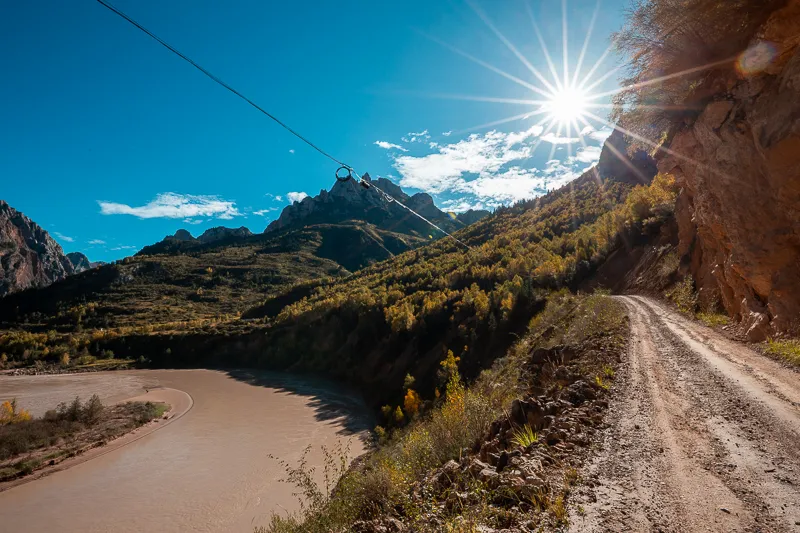
A rough road squeezed between the river and the mountain
Canon EOS 6D
EF 16-35 f/2.8L III USM
F16 | 1/100 s | 16mm | ISO 100
From Niangla Township to Nangqên County, many sections of the road run through narrow valleys. The road itself has been cut directly into the mountainside, and driving through it feels almost like traveling inside a tunnel. On the other side, where there is no mountain, turbulent river water rushes past, its roar deafening in the silence of the night.
In the dim moonlight, the scenery outside seemed to appear and disappear. Water was thrown upward by the uneven riverbed and crashed back into itself in enormous splashes. The moonlight placed a strange veil over it, making the river look unusually fierce and intimidating.
I had expected the drive to Nangqên County to take a little over an hour, but in the end it took more than three. At around 11:30 p.m., we finally reached the county town. Nangqên was relatively underdeveloped. The roads were wide but in poor condition, while the uneven rows of houses made the town look somewhat worn. There were very few well-reviewed hotels, so we drove around several times before finally finding somewhere to stay, bringing this busy and satisfying first day to an end.
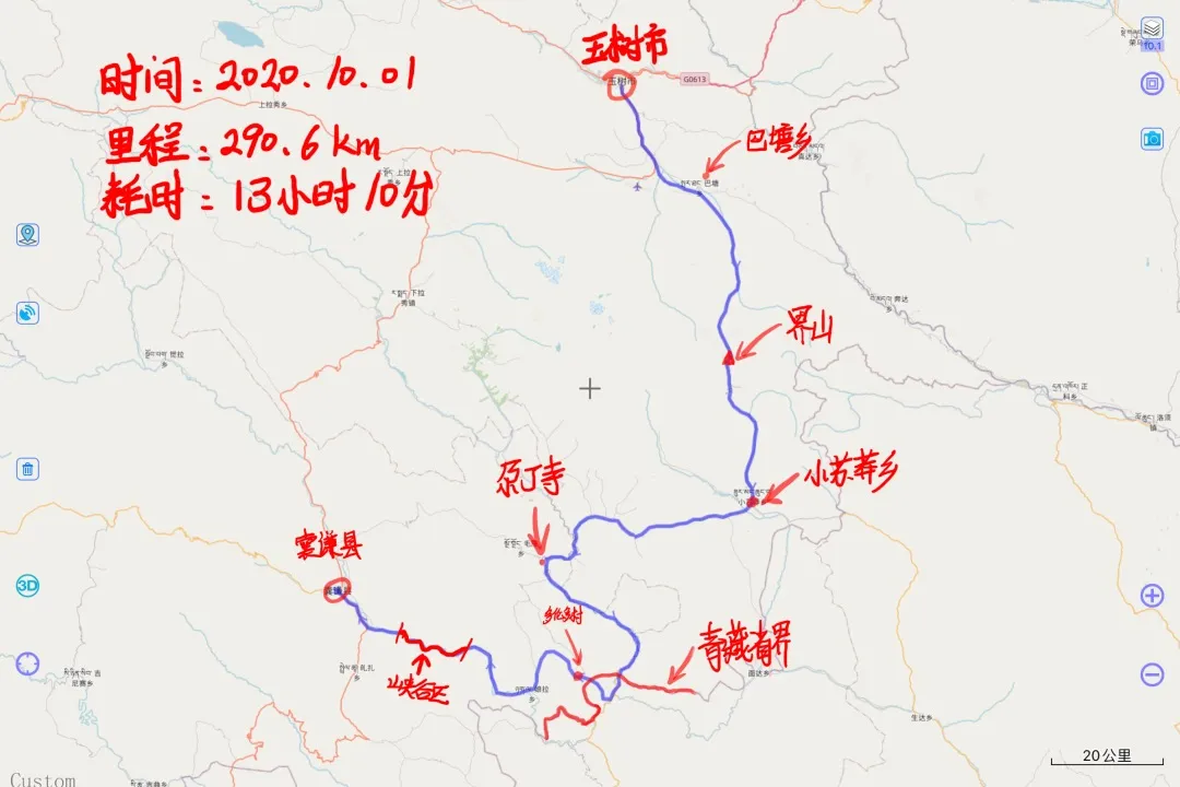
Route map for Day 4
· END ·