Toward Yushu, Crossing the Yellow River Three Times
Contents
The Yellow River flows eastward from its source at Yueguzongliequ, but not long after entering Sichuan Province, it turns back toward the northwest and re-enters Qinghai. In doing so, it brings abundant water to eastern Qinghai and irrigates the fertile land along both banks.
01
It was nearly noon when we left Xining, Qinghai, almost two hours later than planned. But because Xining lies in western China, local solar time is roughly 10:30 in the morning when Beijing time reaches noon. That made the delayed departure feel a little less worrying.
Driving south from Xining along the Nanchuan valley, we soon reached Huangzhong County. This is where Kumbum Monastery is located, the birthplace of Tsongkhapa, founder of the Gelug school of Tibetan Buddhism. Continuing south and crossing Laji Mountain, a branch of the Qilian Mountains, red Danxia landforms gradually began to appear. This meant we had entered Guide County in Hainan Prefecture. Guide is sometimes called the “Little Jiangnan of Qinghai”. Its climate is milder and wetter than Xining’s, and the broad Yellow River flows past the county town through rich grassland.
“Of all the Yellow River, the clearest is at Guide.” Without coming here, it is difficult to imagine that the muddy Yellow River, carrying so much sediment downstream, can be this clear and green more than a thousand kilometers upstream. It is like a handsome young man who has not yet grown up, delicate in appearance but already showing signs of great strength. The broad, clear river nourishes both banks around Guide and, together with the mild climate, gives the area its reputation as the “Little Jiangnan of Qinghai”. This was where we crossed the Yellow River for the first time.
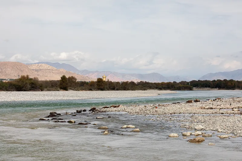
The Yellow River at Guide
Canon EOS 5D Mark IV
EF 70-200 f/2.8L IS III USM
F16 | 1/100 s | 88mm | ISO 100
Continuing south along G227, we crossed several mountains before reaching Guomaying Town. Guomaying belongs to Guinan County in Hainan Prefecture and lies on the main route between Guide and Guinan. According to the plan, we would turn west from Guomaying, reach the mountaintop near Longyang Gorge, and then loop counterclockwise back to Guomaying. Longyang Gorge lies in Gonghe County, Hainan Prefecture. It is the first major canyon the Yellow River enters after flowing out of the grasslands near its source. The terrain is particularly suitable for hydropower development, and in the 1980s the first large hydropower station on the upper Yellow River, Longyangxia Hydropower Station, was built here.
By the time we reached Guomaying, it was already close to 4:30 in the afternoon. According to the original plan, we were supposed to reach Maqên County in Golog Prefecture that night, but the distance from Guomaying to Maqên was more than 260 kilometers and would take at least four and a half hours. Unless we abandoned Longyang Gorge, there was no chance of reaching Maqên before midnight. After some discussion, we revised the plan: we would still go to Longyang Gorge but shorten the route, and we would choose a place to stop for the night based on the time rather than insist on reaching Maqên.
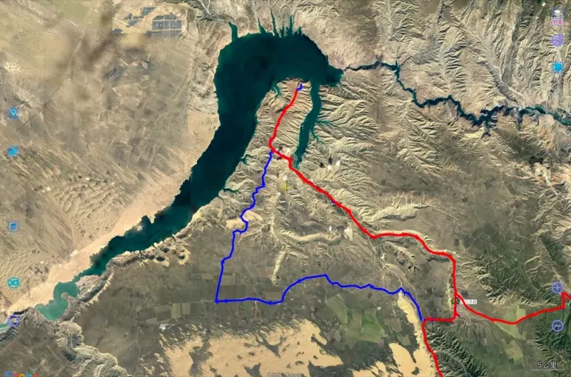
The original plan was to follow the red and blue lines counterclockwise, but in the end we only completed the red section.
From the satellite image, Longyang Gorge really does look like a dragon’s head.
From the satellite map, the mountaintop south of Longyang Gorge looked flat and the route seemed clear. In reality, the road was uneven and full of potholes, making it extremely uncomfortable to drive. I had expected to maintain around 40 km/h, but even 20 km/h was difficult, pushing our already delayed schedule further behind.
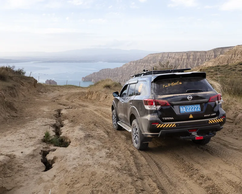
A road full of potholes
We followed the GPS track north. With about ten kilometers left before the water, the view gradually opened up and the shimmering surface of the reservoir appeared ahead. After hurrying all the way, we finally reached the cliff beside the lake before sunset. Unfortunately, the view from this particular spot was not especially impressive, only a broad outlook and somewhat hazy air in the evening light.
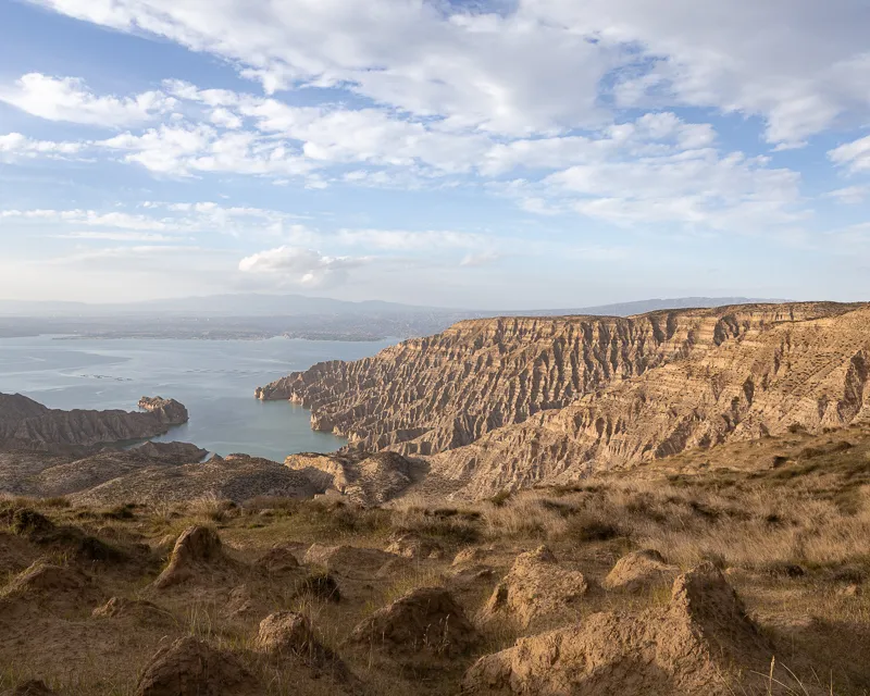
Sunset at Longyang Gorge
Canon EOS 6D
EF 24-70 f/2.8 II USM
F11 | 1/100 s | 24mm | ISO 100
On the way back, darkness gradually settled in. Hares that had been hiding in their burrows throughout the day began coming out, running across the road in small groups. Following the GPS track from earlier, the car bounced its way back to Guomaying almost without us noticing.
The rest of the journey passed along plateau highways where phone reception came and went. Fortunately, National Day was close to the Mid-Autumn Festival, and the moonlight gave the distant mountains rough silhouettes, making the drive less dull. Looking at the time and distance, the best we could manage on the first day was to stop in Guinan County, Hainan Prefecture.
One thing about the hotels in Guinan deserves mentioning: somehow, three of them were named “Yongfu”. I could only smile to myself. I had traveled thousands of kilometers from the Fu Factory in Yongfu Village, Hangzhou, all the way to Hainan Prefecture in Qinghai, and still could not escape Yongfu following me around. Was this fate?
02
At around eight the next morning, we began another day’s journey. Leaving Guinan County, we entered a broad and empty plain. Groups of combine harvesters appeared from time to time along the road, moving busily through fields planted with different crops. It was clearly harvest season.
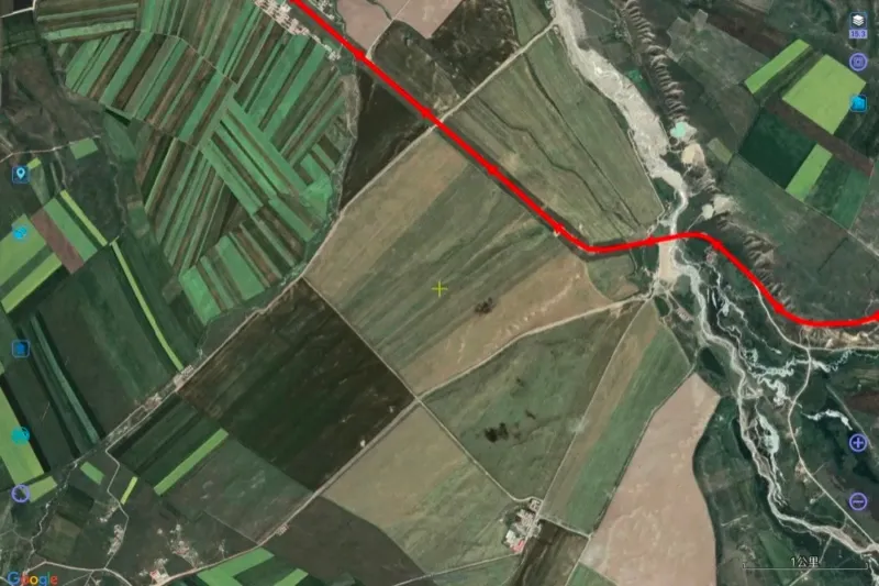
Large areas of farmland around Guinan seen from satellite imagery
After crossing several unnamed passes and driving dozens of kilometers on paved roads, the previously open and gentle slopes gradually tightened. Before long, the road entered a valley. Steep rock walls on both sides squeezed the road together with a fast-flowing river, winding left and right through the canyon. Not long after leaving the gorge, we reached Lajia Town in Maqên County, Golog Tibetan Autonomous Prefecture. Lajia is built along both banks of the Yellow River and is relatively busy. Tourists, traders, monks and local residents filled the streets. Here, we crossed the Yellow River for the second time.
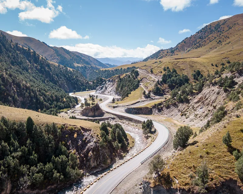
The canyon
After resting in Lajia and having lunch, we continued south. Before long, we reached Maqên County, the seat of Golog Prefecture. The county town lies at around 3,800 meters above sea level in northern Golog. From my own impression, among the prefectural capitals in Qinghai, Maqên feels relatively underdeveloped. Since we were short on time, we did not stop and continued south toward Darlag County. The section from Maqên through Gadê to Darlag did not bring many surprises. The car moved through broad, gentle mountains while sunlight squeezed between the clouds and shifted constantly across the grasslands below. Yaks and sheep covered the distant hills and valleys, some lying down and some standing, all looking relaxed.
A little more than ten kilometers before reaching Darlag County, we crossed the Yellow River for the third time. The sky was filled with clouds, some black and some white, bringing patches of rain and shade. As the clouds moved, the sunlight changed rapidly and disappeared almost as soon as it appeared.
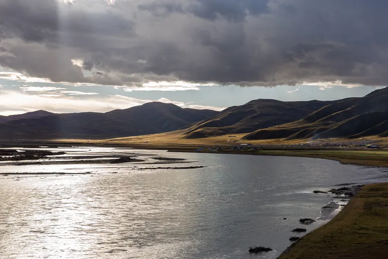
The Yellow River
Canon EOS 6D
EF 24-70mm f/2.8L II
F14 | 1/60 s | 70mm | ISO 100
According to the revised plan, Darlag County was supposed to be the end of the second day’s journey. But when we arrived, it was still relatively early and did not seem worth stopping for the night. So we changed the plan again and made Sêrxü County in Garzê, Sichuan, our new destination. There was one drawback: we would miss the scenery along the newly opened Darlag–Sêrxü road because we would be driving at night. But there were two advantages. The road had opened only at the end of 2019, so it should be in relatively good condition and safer after dark. The change would also put us around 250 kilometers ahead of the original schedule and make up some of the distance we had lost.
But this seemingly uneventful 250-kilometer night drive brought the first real surprise of the journey.
· END ·